Amazon of Europe Bike Trail S08 Đurđevac – Pitomača
Max elevation: 130 m
Min elevation: 105 m
Total climbing: 239 m
Total descent: -244 m
Technical info
Line route
| Length: | 36.3 km |
| Altitude difference: | 11 m |
| Total ascent: | 50 m |
| Total descent: | 56 m |
| Surface: | asphalt |
Amazon of Europe Bike Trail S07 Koprivnica – Đurđevac
Max elevation: 139 m
Min elevation: 111 m
Total climbing: 387 m
Total descent: -404 m
Technical info
Line route
| Length: | 50.7 km |
| Altitude difference: | 11 m |
| Total ascent: | 77 m |
| Total descent: | 96 m |
| Surface: | asphalt |
Amazon of Europe Bike Trail S06 Prelog – Koprivnica
Max elevation: 153 m
Min elevation: 122 m
Total climbing: 327 m
Total descent: -337 m
Technical info
Line route
| Length: | 55.9 km |
| Altitude difference: | 11 m |
| Total ascent: | 53 m |
| Total descent: | 62 m |
| Surface: | asphalt |
Line route Šoderica – Gola
Max elevation: 129 m
Min elevation: 119 m
Total climbing: 33 m
Total descent: -38 m
Technical info
Vezna ruta
| Length: | 17,75 km |
| Altitude difference: | 11 m |
| Total ascent: | 60 m |
| Total descent: | 65 m |
| Surface: | asphalt |
Line route Legrad – Ludbreg
Max elevation: 139 m
Min elevation: 128 m
Total climbing: 15 m
Total descent: -23 m
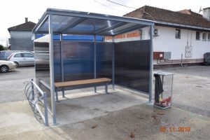
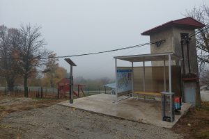
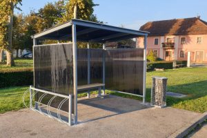
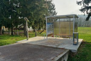
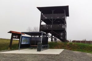
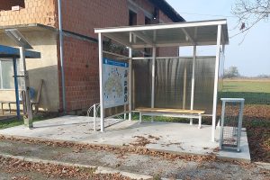
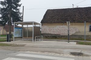
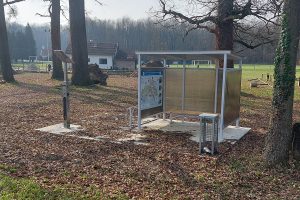
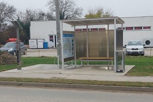
Rest stops and service stations
1. Legrad, Trg svetog Trojstva, 46.297516N 16.856211E
Technical info
Rest stops and service stations: Legrad
Line route
| Length: | 8,35 km |
| Altitude difference: | 12 m |
| Total ascent: | 28 m |
| Total descent: | 37 m |
| Surface: | asphalt |
Line route Križevci – Vrbovec
Max elevation: 159 m
Min elevation: 119 m
Total climbing: 88 m
Total descent: -110 m
Technical info
Line route
| Length: | 11,64 km |
| Altitude difference: | 40 m |
| Total ascent: | 96 m |
| Total descent: | 116 m |
| Surface: | asphalt |
Line route Križevci – Marija Bistrica
Max elevation: 184 m
Min elevation: 120 m
Total climbing: 118 m
Total descent: -131 m
Technical info
Line route
| Length: | 7,78 km |
| Altitude difference: | 68 m |
| Total ascent: | 119 m |
| Total descent: | 69 m |
| Surface: | asphalt |
Line route Koprivnica – Bjelovar
Max elevation: 291 m
Min elevation: 159 m
Total climbing: 0 m
Total descent: -132 m
Technical info
Line route
| Length: | 3,68 km |
| Altitude difference: | 134 m |
| Total ascent: | 1 m |
| Total descent: | 134 m |
| Surface: | asphalt |
New Prekodravlje route
Max elevation: 122 m
Min elevation: 106 m
Total climbing: 161 m
Total descent: -173 m
Rest stops and service stations
1. Kalinovac, Ulica Stjepana Radića
46.024643N 17.113073E
Technical info
Passes through: Đurđevac – Kalinovac – Podravske Sesvete – Ferdinandovac – Kalinovac – Đurđevac
Rest stops and service stations: Kalinovac
Circular route
| Length: | 40,57 km |
| Altitude difference: | 18 m |
| Total ascent: | 214 m |
| Total descent: | 219 m |
| Surface: | asphalt |
Kalnik route
Max elevation: 303 m
Min elevation: 135 m
Total climbing: 337 m
Total descent: -334 m
Technical info
Passes through: Koprivnica – Kunovec Breg – Subotica Podravska – Rasinja – Prkos – Veliki Grabičani – Veliki Poganac – Apatovec – Jarčani – Glogovnica – Ivanec Križevački – Križevci
| Length: | 41 km |
| Altitude difference: | 169 m |
| Total ascent: | 349 m |
| Total descent: | 347 m |
| Surface: | asphalt |
Rest stops and service stations
1. Rasinja, Vinogradska ulica
46.187152N 16.710474E
2. Križevci 1 – Špiranec
45.980390N 16.508810E
3. Apatovec
46.147613N 16.572917E
Bilogora route
Max elevation: 297 m
Min elevation: 124 m
Total climbing: 873 m
Total descent: -871 m
Technical info
Passes through: Križevci – Đurđic – Sv. Petar Čvrstec – Ruševac – Većeslavec – Jagnjedovec – Koprivnica
| Length: | 43,3 km |
| Altitude difference: | 179 m |
| Total ascent: | 773 m |
| Total descent: | 775 m |
| Surface: | asphalt |
Rest stops and service stations
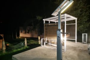
1. Mala Mučna
46.064107N 16.734244E
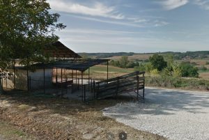
2. Sveti Petar Čvrstec
46.006750N 16.663146E
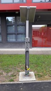
3. Križevci, Trg svetog Florijana
46.02018N 16.54344E
D7 Balaton – Lonjsko polje
Max elevation: 217 m
Min elevation: 114 m
Total climbing: 375 m
Total descent: -319 m
Technical info
Passes through: Sirova Katalena – Čepelovac – Đurđevac – Molve – Repaš – Novačka – Gola
| Length: | 43,3 km |
| Altitude difference: | 103 m |
| Total ascent: | 374 m |
| Total descent: | 318 m |
| Surface: | asphalt |
Rest stops, service stations and info points
1. Gola, Ulica Stjepana Radića
46.197886N 17.058497E
2. Mali Kostanj, Mičetinac
46.011912N 17.022799E
3. Sirova Katalena
45.960867N 17.063183E
D1 and EV Drava route
Max elevation: 142 m
Min elevation: 107 m
Total climbing: 389 m
Total descent: -414 m
This bike route starts at Donja Dubrava bridge and follows the Drava to Podravske Sesvete. The route is 84 kilometers long, well marked, easy to ride and navigate. Ideal for family tourism and recreation. The route avoids long stretches through same landscape and does not pass only through main streets of towns and villages; it winds through fields and forests, sometimes on unpaved paths, taking cyclists to hidden settlements where life plays out in small open yards, right before the eyes of passengers. The route goes through beautiful landscapes, touches Lake Šoderica, visits world famous Hlebine, passes through rich hunting grounds and occasionally by the Drava itself. This lowland route offers many opportunities to divert to wooded hills and vineyards of Bilogora, parallel with the Drava valley, making this cycling experience even more interesting.
Technical info
Passes through: Podravske Sesvete – Ferdinandovac – Novo Virje – Molve – Hlebine – Koprivnički Bregi – Koprivnica – Torčec – Đelekovec – Legrad
Rest stops, service stations and info points: Ferdinandovac, Hlebine, Molve, Molve Grede, Koprivnički Bregi, Novo Virje, Đelekovec
| Length: | 83,6 km |
| Altitude difference: | 35 m |
| Total ascent: | 387 m |
| Total descent: | 412 m |
| Surface: | asfalt |
Rest stops and service stations
1. Ferdinandovac, Trg slobode
46.059822N 17.191475E
2. Hlebine, Ljudevita Gaja
46.151133N 16.966879E
3. Molve, Trg kralja Tomislava
46.106261N 17.033142E
4. Molve Grede
46.108368N 17.072956E
5. Koprivnički Bregi, Ulica Matije Gupca
46.144155N 16.895009E
6. Novo Virje, Ulica Širine
46.099800N 17.126313E

 Hrvatski

